Local Projects
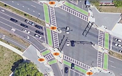
Transit Signal Priority Could Reduce Silver Line Delay by 90% Where It Crosses D Street in the Seaport
"Why? Why? WHY?," thousands of people have wondered. Where the Silver Line Waterfront lines (to/from Logan Airport, etc.) cross D Street in Boston's Seaport district, buses can be delayed by almost 2 minutes at a red light ... while scarcely any traffic goes by on D...

Bus-Friendly Traffic Signals Can Reduce Bus Delay By 90% on South Huntington Avenue
Introduction At two intersections on Boston’s South Huntington Avenue – intersections with Perkins St. and Bynner St. (Figure 1) – buses on Route 39, the MBTA’s fourth-busiest bus route, experience an average combined delay of 43 s. This post will explain how, with...
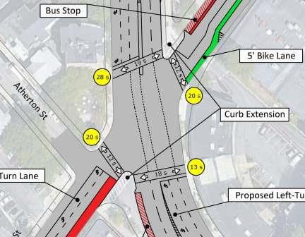
Will Protected Bike Lanes Fit on Blue Hill Ave?
It's been decided: Blue Hill Ave will have center running bus lanes. Whether it will have protected bike lanes is yet to be determined, and it depends heavily on whether they can fit without sacrificing mature trees, parking lanes, or traffic capacity. This set of...

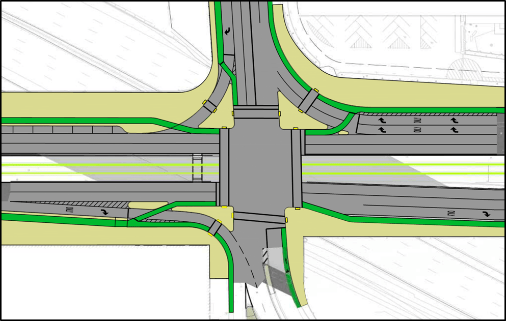
Improving the Mass Ave / Memorial Drive Intersection
With a new intersection layout and revised signal timing at Mass. Ave. and Memorial Drive, through traffic can be reduced to a single lane per direction, creating space for new bike lanes, a bus lane, and protecting bikes from a heavy right turn flow.
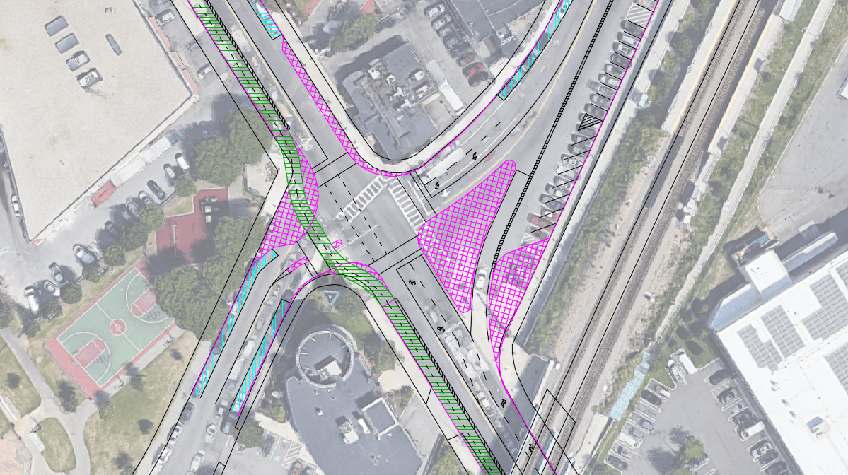
Poor Signal Phase Coordination Results in 4-Minute Pedestrian Delay at Forest Hills
Casey Arborway, at Forest Hills in Boston, is a newly constructed roadway with a lot of good features for bikes, transit, and pedestrians, such as cycle tracks, bike signals, relatively small footprint intersections (for the volume of traffic carried), and a left turn...
Mass Ave (Boston) @ Newmarket Square: Intersection Design for a Road Diet
Providing a protected bike lane, or cycle track, along "Mass Ave South" -- that is, Mass. Ave. from Melnea Cass Blvd to Columbia Rd (Edward Everett Square) is critical for Boston's bike network. This creates a traffic engineering challenge -- how to find the space for...
Cummins Highway: Making it Safe and Green
Click here for traffic simulation of the proposed layout Cummins Highway, between Mattapan Square and the cemeteries just west of Wood Ave. / Harvard St., is an auto-oriented, 4-lane divided road passing through the middle of Boston's Mattapan neighborhood. In one...
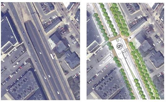
Arborway
Redesign Project, 2008 Arborway, between Jamaica Pond and the Arboretum, has 8 lanes of through traffic. This student project, done in 2008, shows how the road's footprint can be severely reduced, creating 4.5 net acres of accessible parkland and continuous walking /...
A People-Friendly Egleston Square Intersection Design
Egleston Square is a mess, and so it’s encouraging to see that the City has advanced two concepts for reimagining this intersection (follow this link to see those concepts). Concept 1 focuses on reducing pedestrian crossing distances and waiting times, while Concept 2...
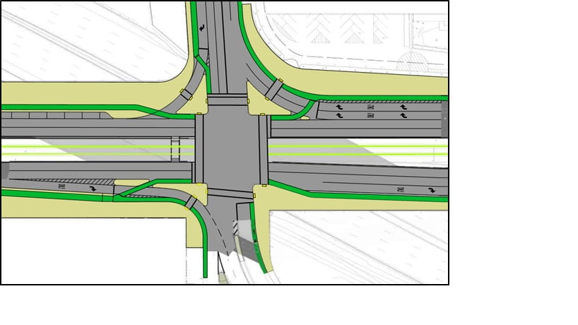
Comm. Ave. @ BU Bridge: A Compact Intersection Based on a Copenhagen Design
Graduate student Jeff Bachiochi designed a compact intersection based on a Copenhagen design that allows bikes and pedestrians to cross concurrently, yet protected from high right-turn volumes - an efficient design that results in a short cycle and short delays for...
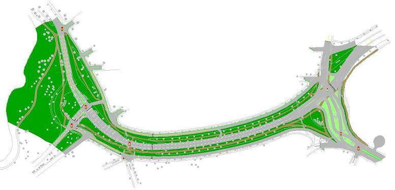
Rutherford Avenue and Sullivan Square
Since 2008, the City of Boston has been planning a project to convert Rutherford Avenue in Charlestown from a wide highway into a boulevard with a linear park, and to convert the oversized rotary and vehicle-oriented streets in Sullivan Square into a walkable urban...
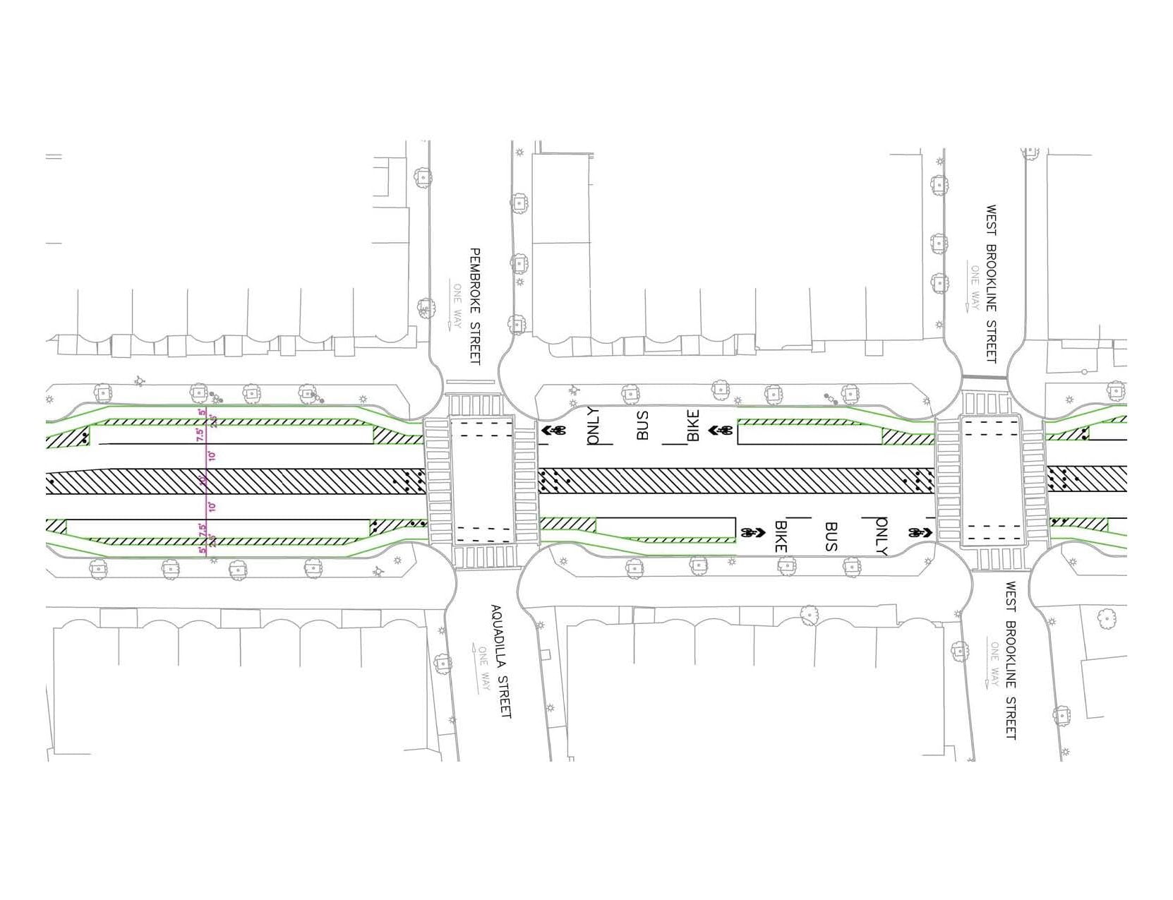
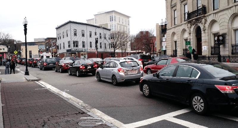
Tremont Street in Boston’s South End
Two pedestrians have recently been killed crossing Tremont Street in Boston' South End. The current layout - 4 lanes, undivided - leads to reckless speeding and makes it difficult to cross the street. Rampant double parking offers evidence that four lanes aren't...
Rutherford Ave @ Austin Street: A Surface Option that Works and the Failed Promise of the Underpass Option
(Editor's note, 4/8/2018: Since this report was first published in February, 2018, we are glad to report that the Boston Transportation Department has modified its design by adding the delta islands that are part of our proposal, so that its plan now includes safe...
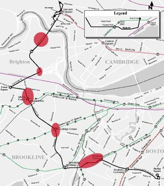
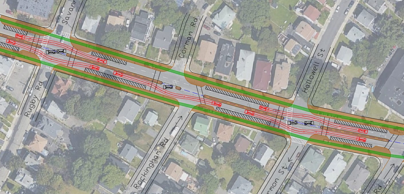
Congestion Protection for Route 66
Chris Boll, a Master's student in civil engineering, took inspiration from best practices in Brussels, Zurich, and Dublin to develop ways to protect Route 66 from traffic congestion at five "hot spots" that include Mission Hill, Coolidge Corner, Allston Village, the...
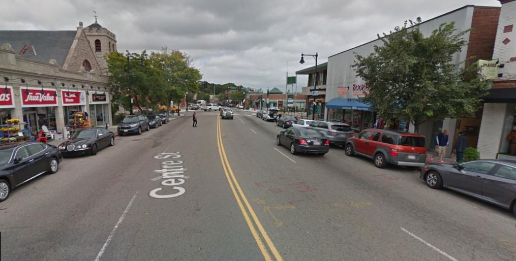
Road Diet for Centre Street, West Roxbury
Centre St between Lagrange St and Esther Street (near Holy Name Circle) is West Roxbury's main street, flanked by shops and businesses. It has 3 bus routes, a nearby commuter rail station, and several nearby schools that further contribute to pedestrian traffic. For...
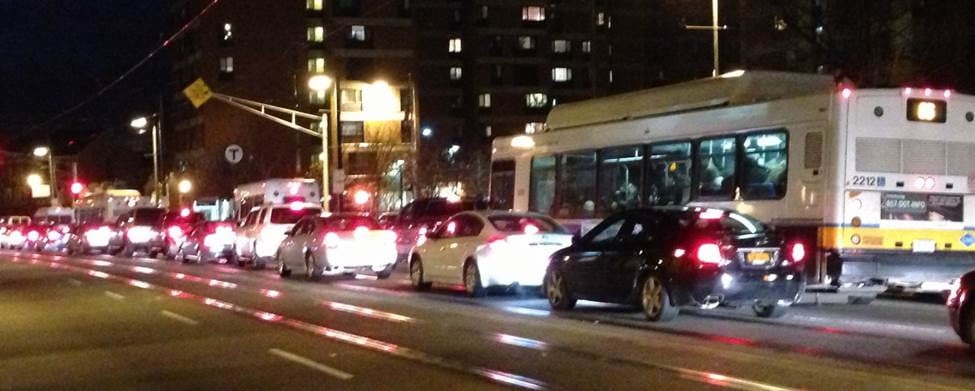
Transit Lanes on Huntington Av (Mission Hill section)
The Mission Hill stretch of Huntington Av, between Brigham Circle and South Huntington Ave., can be so congested that it's quicker to walk than to ride the train or bus. While buses and Green Line trains represent only 3% of the traffic, they carry 70% of the people -...
Improving Pedestrian Access to Franklin Park
UPDATE, 2017: The new park entrance for ped/bike that we recommended is under construction! (Franklin Hill Ave. @ American Legion Hwy) The limited number of entrances and poor crossing provisions across the busy roads bordering Boston's Franklin Park limit its...
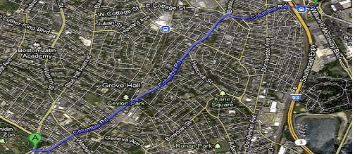
Making Columbia Road a Greenway for Cycling and Walking
Columbia Road was originally envisioned as a link in Boston's Emerald Necklace, a string of linear parks encircling Boston with paths for travel by foot, by carriage (later, car) and by horse (later, bicycle). It was to be a greenway link from Franklin Park to the...
Improving Silver Line Speed and Reliability near Dudley Square
Silver Line buses suffer large and highly variable delays on Washington Street near Dudley Station. Master's student (now graduate) Guillerme Nakao studied the stretch of Washington Street from Melnea Cass Blvd to Dudley Station and identified two bottlenecks: the...
Improving Ped, Bike, and Car Service and Safety Using Delta Islands at the Comm Ave / BU Bridge Intersection
A unique intersection design for the junction of Comm Ave with the BU Bridge can reduce delay for all users, reduce the length of pedestrian crossings, and protect crossings that would otherwise face heavy conflicting right-turning traffic. Master's student (now...